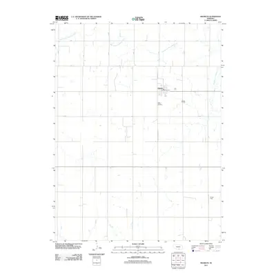
2011 Map of Hildreth
USGS Topo · Published 2011About this map
Hildreth serves as the central hub of this agricultural landscape in Franklin County, characterized by a meticulous grid of rural roads and the winding path of the West Branch Thompson Creek. The village contains essential local landmarks such as the Hildreth Post Office and the intersection of W Avenue St. Local history and genealogy researchers will find two significant burial grounds documented south of the village center: Saint Peters Cemetery and Hildreth Cemetery. Outside the residential core, the map detail extends to Bunger Field and traces the modern transport corridor of the Harold Jurgens Expy. The terrain is defined by its section-line roads, including A Rd and B Rd, which underscore the organized land division typical of the Great Plains.
Find a feature on this map
17 named features on this map. Tap any name to fly to it.
Don’t see what you’re looking for? This feature index may not catch every label — zoom into the map to look around manually.
Map Details
Editions of this 2011 Hildreth Map
This is the sole edition of this map. No revisions or reprints were ever made.
Other maps of this area

1896 · Holdrege
USGS Topo · 1:125,000

1897 · Red Cloud
USGS Topo · 1:125,000

1955 · Grand Island
USGS Topo · 1:250,000

1957 · Grand Island
USGS Topo · 1:250,000

1958 · Grand Island
USGS Topo · 1:250,000

1969 · Upland
USGS Topo · 1:24,000
1969 · Minden South
USGS Topo · 1:24,000

1970 · Axtell West
USGS Topo · 1:24,000
1970 · Axtell East
USGS Topo · 1:24,000

1970 · Wilcox
USGS Topo · 1:24,000