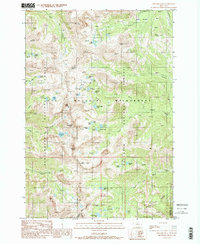
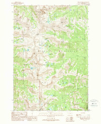
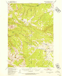
1988 Map of Hilgard Peak
USGS Topo · Published 1989About this map
Lee Metcalf Wilderness defines this high-elevation landscape, where the Madison and Gallatin county lines meet along the dramatic crests of the Taylor Hilgard Range. The area is characterized by an exceptional density of alpine water bodies, including Cradle Lakes, Echo Lake, and the aptly named Blue Paradise Lake. This provisional survey captures the primitive character of the terrain just before the close of the 1980s, highlighting a network of narrow trails such as the Pack Trail that provide the only access through these protected lands.
Find a feature on this map
55 named features on this map. Tap any name to fly to it.
Don’t see what you’re looking for? This feature index may not catch every label — zoom into the map to look around manually.
Map Details
Editions of this 1988 Hilgard Peak Map
2 editions found
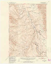
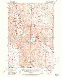
Other maps of this area

1888 · Three Forks
USGS Topo · 1:250,000

1894 · Three Forks
USGS Topo · 1:250,000

1895 · Three Forks
USGS Topo · 1:250,000

1947 · Bozeman
USGS Topo · 1:250,000

1948 · Bozeman
USGS Topo · 1:250,000
1950 · Cliff Lake
USGS Topo · 1:62,500
1950 · Hebgen Dam
USGS Topo · 1:62,500
1950 · Cameron
USGS Topo · 1:62,500
1950 · Sphinx Mountain
USGS Topo · 1:62,500

1955 · Bozeman
USGS Topo · 1:250,000