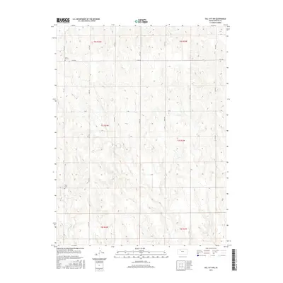
2015 Map of Hill City NW
USGS Topo · Published 2015About this map
Bow Creek and Rock Creek define the drainage of this northwestern Graham County landscape, where the high plains of western Kansas are dissected by a network of seasonal draws and creeks. The area is structured by a strictly rectilinear grid of section-line roads, including Co Rd 380 and 220th Ave, reflecting the enduring legacy of the Public Land Survey System. For family historians and genealogists, two specific burial grounds serve as significant landmarks within this rural expanse: South Star Cemetery in the northwest and Rock Creek Cemetery further south. These sites, often associated with early homesteading communities, remain as physical anchors in a territory dominated by expansive agricultural tracts and the winding course of Rock Creek.
Find a feature on this map
26 named features on this map. Tap any name to fly to it.
Don’t see what you’re looking for? This feature index may not catch every label — zoom into the map to look around manually.
Map Details
Editions of this 2015 Hill City NW Map
This is the sole edition of this map. No revisions or reprints were ever made.
Other maps of this area

1893 · Norton
USGS Topo · 1:125,000

1893 · Hill
USGS Topo · 1:125,000

1954 · Goodland
USGS Topo · 1:250,000

1955 · Beloit
USGS Topo · 1:250,000

1956 · Goodland
USGS Topo · 1:250,000

1957 · Goodland
USGS Topo · 1:250,000

1959 · Beloit
USGS Topo · 1:250,000

1978 · Lenora East
USGS Topo · 1:24,000

1978 · Lenora West
USGS Topo · 1:24,000

1978 · Edmond SE
USGS Topo · 1:24,000