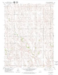
1979 Map of Hill City NW
USGS Topo · Published 1979About this map
Indiana and Gettysburg townships define this corner of Graham County, where the plains are deeply dissected by the drainages of Bow Creek, Coon Creek, and the winding Sand Creek. The landscape is a mix of agricultural utility and resource extraction, evidenced by various oil wells and several quarries situated near the banks of Rock Creek. Local history is anchored by the South Star Cem in the north and Rock Creek Cem further south, providing clear reference points for genealogists. The presence of a Community Hall in the Indiana section suggests a hub for rural social life amidst the widespread field lines and fences that partition this high plains terrain.
Find a feature on this map
15 named features on this map. Tap any name to fly to it.
Don’t see what you’re looking for? This feature index may not catch every label — zoom into the map to look around manually.
Map Details
Editions of this 1979 Hill City NW Map
This is the sole edition of this map. No revisions or reprints were ever made.
Other maps of this area

1893 · Norton
USGS Topo · 1:125,000

1893 · Hill
USGS Topo · 1:125,000

1954 · Goodland
USGS Topo · 1:250,000

1955 · Beloit
USGS Topo · 1:250,000

1956 · Goodland
USGS Topo · 1:250,000

1957 · Goodland
USGS Topo · 1:250,000

1959 · Beloit
USGS Topo · 1:250,000

1978 · Lenora East
USGS Topo · 1:24,000

1978 · Lenora West
USGS Topo · 1:24,000

1978 · Edmond SE
USGS Topo · 1:24,000