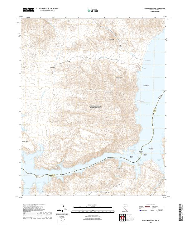
2021 Map of Hiller Mountains
USGS Topo · Published 2021About this map
Lake Mead National Recreation Area dominates this landscape where the Colorado River's impounded waters reach into the desert topography of Clark County, Nevada, and Mohave County, Arizona. The map details the transition from the high ridges of the Hiller Mountains and Gregg Peak down to the complex shoreline of Lake Mead. In the southern portion of the sheet, the waters of Virgin Canyon and Gregg Basin meet, creating a network of inlets such as Gold Cross Bay and Reef Bay. The presence of named points like Greggs Hideout and Rocky Point suggests the recreational and navigational importance of these waters, while interior features like Jumbo Pass and Burro Spring indicate the sparse but vital water sources and travel routes through the surrounding Mojave Desert. This 2021 survey illustrates the modern extent of the reservoir against the backdrop of ancient terrain features like Temple Mesa.
Find a feature on this map
48 named features on this map. Tap any name to fly to it.
Don’t see what you’re looking for? This feature index may not catch every label — zoom into the map to look around manually.
Map Details
Editions of this 2021 Hiller Mountains Map
This is the sole edition of this map. No revisions or reprints were ever made.
Other maps of this area

1886 · Camp Mohave
USGS Topo · 1:250,000

1886 · Saint Thomas
USGS Topo · 1:250,000

1892 · Camp Mohave
USGS Topo · 1:250,000

1893 · Saint Thomas
USGS Topo · 1:250,000

1926 · Bonelli
USGS Topo · 1:96,000

1942 · Camp Mohave
USGS Topo · 1:250,000

1947 · Kingman
USGS Topo · 1:250,000

1948 · Kingman
USGS Topo · 1:250,000

1953 · Iceberg Canyon
USGS Topo · 1:62,500

1953 · Virgin Basin
USGS Topo · 1:62,500