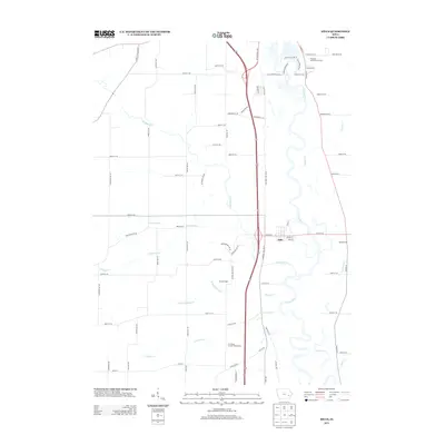
2013 Map of Hills
USGS Topo · Published 2013About this map
The Iowa River meanders through the eastern portion of this landscape, its winding course defining the geography south of Iowa City. The town of Hills serves as a central point of settlement along the highway corridor, while several smaller named locales like Bon Accord, Morfordsville, and Seventy Eight indicate historical points of interest or rural neighborhoods. A dense network of local roads such as Old Highway 218 and Sharon Center Road connect these agricultural lands.
Find a feature on this map
78 named features on this map. Tap any name to fly to it.
Don’t see what you’re looking for? This feature index may not catch every label — zoom into the map to look around manually.
Map Details
Editions of this 2013 Hills Map
This is the sole edition of this map. No revisions or reprints were ever made.
Other maps of this area

1891 · Iowa City
USGS Topo · 1:62,500

1894 · West Liberty
USGS Topo · 1:62,500

1901 · Stanwood
USGS Topo · 1:125,000

1903 · Fairfax
USGS Topo · 1:125,000

1938 · Iowa City
USGS Topo · 1:62,500

1958 · Davenport
USGS Topo · 1:250,000

1961 · Davenport
USGS Topo · 1:250,000

1962 · Davenport
USGS Topo · 1:250,000

1965 · Williamstown
USGS Topo · 1:24,000
1965 · Tiffin
USGS Topo · 1:24,000