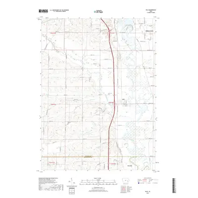
2018 Map of Hills
USGS Topo · Published 2018About this map
Iowa City extends its southern reach into this landscape, where the Iowa River valley dictates the placement of settlements and transport corridors. The town of Hills serves as a central hub, situated near the confluence of Old Mans Creek and the river, while Riverside marks the southern extent across the Johnson and Washington County line. The terrain is defined by a dense network of drainage, including Dirty Face Creek and the various forks of Liberty Creek, which have shaped the agricultural grid of the region.
Find a feature on this map
89 named features on this map. Tap any name to fly to it.
Don’t see what you’re looking for? This feature index may not catch every label — zoom into the map to look around manually.
Map Details
Editions of this 2018 Hills Map
This is the sole edition of this map. No revisions or reprints were ever made.
Other maps of this area

1891 · Iowa City
USGS Topo · 1:62,500

1894 · West Liberty
USGS Topo · 1:62,500

1901 · Stanwood
USGS Topo · 1:125,000

1903 · Fairfax
USGS Topo · 1:125,000

1938 · Iowa City
USGS Topo · 1:62,500

1958 · Davenport
USGS Topo · 1:250,000

1961 · Davenport
USGS Topo · 1:250,000

1962 · Davenport
USGS Topo · 1:250,000

1965 · Williamstown
USGS Topo · 1:24,000
1965 · Tiffin
USGS Topo · 1:24,000