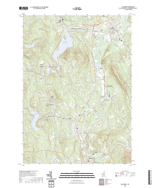
2024 Map of Hillsboro
USGS Topo · Published 2024About this map
Hillsboro and its surrounding villages define this New Hampshire landscape, where the Contoocook River and the North Branch River converge. The topography is dominated by numerous peaks such as Riley Mtn, Gibson Mtn, and Meetinghouse Hill, while the Hillsborough Rec Rail Trail traces a historical transport corridor through the valley. This modern survey captures the region's enduring character, from the active hubs of Antrim and Bennington to the smaller hamlets of Hillsboro Lower Village, North Branch, and West Deering.
Find a feature on this map
73 named features on this map. Tap any name to fly to it.
Don’t see what you’re looking for? This feature index may not catch every label — zoom into the map to look around manually.
Map Details
Editions of this 2024 Hillsboro Map
This is the sole edition of this map. No revisions or reprints were ever made.
Other maps of this area

1898 · Monadnock
USGS Topo · 1:62,500

1900 · Peterboro
USGS Topo · 1:62,500

1926 · Hillsboro
USGS Topo · 1:62,500

1929 · Hillsboro
USGS Topo · 1:62,500

1930 · Lovewell Mountain
USGS Topo · 1:62,500

1936 · Monadnock
USGS Topo · 1:62,500

1942 · Keene
USGS Topo · 1:125,000

1942 · Lovewell Mountain
USGS Topo · 1:62,500

1943 · Fitchburg
USGS Topo · 1:125,000

1948 · Boston
USGS Topo · 1:250,000