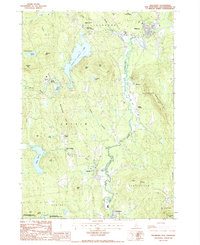
1987 Map of Hillsboro
USGS Topo · Published 1987About this map
The Franklin Pierce Homestead stands as a central historical landmark in this region of southern New Hampshire, situated near the headwaters of the winding Contocook River. The landscape is defined by its significant water bodies, notably the sprawling Franklin Pierce Lake and the smaller, high-elevation Bagley Pond nestled beneath Windsor Mtn. The settlement pattern follows the river and brook valleys, where small population centers like Hillsboro Lower Village, Antrim Center, and Clinton Village indicate a long history of concentrated community growth.
Find a feature on this map
52 named features on this map. Tap any name to fly to it.
Don’t see what you’re looking for? This feature index may not catch every label — zoom into the map to look around manually.
Map Details
Editions of this 1987 Hillsboro Map
This is the sole edition of this map. No revisions or reprints were ever made.
Other maps of this area

1898 · Monadnock
USGS Topo · 1:62,500

1900 · Peterboro
USGS Topo · 1:62,500

1926 · Hillsboro
USGS Topo · 1:62,500

1929 · Hillsboro
USGS Topo · 1:62,500

1930 · Lovewell Mountain
USGS Topo · 1:62,500

1936 · Monadnock
USGS Topo · 1:62,500

1942 · Keene
USGS Topo · 1:125,000

1942 · Lovewell Mountain
USGS Topo · 1:62,500

1943 · Fitchburg
USGS Topo · 1:125,000

1948 · Boston
USGS Topo · 1:250,000