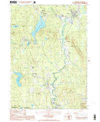
1995 Map of Hillsboro
USGS Topo · Published 1999About this map
The Franklin Pierce Homestead stands as a primary historical landmark in this late twentieth-century survey of the Monadnock region. This map illustrates the intricate network of villages and water bodies that define the local geography, including Hillsboro Lower Village, Clinton Village, and Antrim Center. The Contoocook River and Franklin Pierce Lake dominate the hydrography, while smaller bodies like Gregg Lake and Steels Pond punctuate the landscape. The terrain is marked by significant elevations such as Crotched Mtn, Gibson Mtn, and Hedgehog Hill, reflecting the characteristic New Hampshire relief. Conservation and wildlife interests are highlighted by the Fox State Forest and the Carpenter Marsh State Wildlife Management Area, showing the region's commitment to land preservation alongside its dispersed settlements and local industry, represented by a Quarry near Hillsboro.
Find a feature on this map
50 named features on this map. Tap any name to fly to it.
Don’t see what you’re looking for? This feature index may not catch every label — zoom into the map to look around manually.
Map Details
Editions of this 1995 Hillsboro Map
This is the sole edition of this map. No revisions or reprints were ever made.
Other maps of this area

1898 · Monadnock
USGS Topo · 1:62,500

1900 · Peterboro
USGS Topo · 1:62,500

1926 · Hillsboro
USGS Topo · 1:62,500

1929 · Hillsboro
USGS Topo · 1:62,500

1930 · Lovewell Mountain
USGS Topo · 1:62,500

1936 · Monadnock
USGS Topo · 1:62,500

1942 · Keene
USGS Topo · 1:125,000

1942 · Lovewell Mountain
USGS Topo · 1:62,500

1943 · Fitchburg
USGS Topo · 1:125,000

1948 · Boston
USGS Topo · 1:250,000