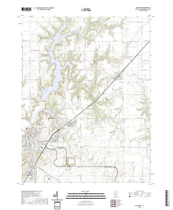
2024 Map of Hillsboro
USGS Topo · Published 2024About this map
Hillsboro serves as the focal point of this 2024 survey, situated at a junction where modern development meets the rolling landscape of Montgomery County. The town's civic heart is marked by the Montgomery County Courthouse, around which the communities of Schram City and Taylor Springs have matured. The surrounding geography is defined by the extensive Shoal Cr Watershed Impoundment Reservoir and Lake Hillsboro, which shape the local hydrology alongside the Middle Fork Shoal Creek. For genealogists and local historians, the map preserves the locations of several burial grounds, including McCord Cem and King Cem, scattered among the rural sections and small settlements like Irving. This modern topographic study illustrates the transition from organized street grids to the expansive tracts of the Farm Service Agency Interest of Illinois.
Find a feature on this map
124 named features on this map. Tap any name to fly to it.
Don’t see what you’re looking for? This feature index may not catch every label — zoom into the map to look around manually.
Map Details
Editions of this 2024 Hillsboro Map
This is the sole edition of this map. No revisions or reprints were ever made.
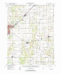
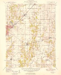
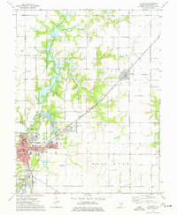
Historical Maps of Irving Through Time
4 maps found