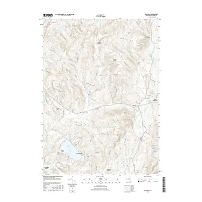
2016 Map of Hillsdale
USGS Topo · Published 2016About this map
Lyon Mountain and the rolling heights of eastern Columbia County define the character of this landscape, where the Taconic foothills meet the valley settlements. The area is anchored by the community of Hillsdale, where the waters of the Roeliff Jansen Kill flow through a valley of well-established homesteads and local landmarks like the Black Grocery Bridge. To the west, Craryville sits along the established road and rail corridor, while the southern portion of the sheet is dominated by the recreational and residential development of Copake Lake and Taconic Shores. Genealogists will find a high density of preserved burial sites across the township, including Crum Cemetery, Niver Cemetery, and the Collins Cemetery near North Hillsdale. The topography transitions from the high peaks of Scutt Hill and Rheinstrom Hill down to the distinct agricultural basins of Pumpkin Hollow and Shepard Hollow, illustrating the enduring relationship between the region's steep geography and its settlement patterns.
Find a feature on this map
123 named features on this map. Tap any name to fly to it.
Don’t see what you’re looking for? This feature index may not catch every label — zoom into the map to look around manually.
Map Details
Editions of this 2016 Hillsdale Map
This is the sole edition of this map. No revisions or reprints were ever made.
Other maps of this area

1885 · Sheffield
USGS Topo · 1:62,500

1888 · Sheffield
USGS Topo · 1:62,500

1888 · Pittsfield
USGS Topo · 1:62,500

1890 · Pittsfield
USGS Topo · 1:62,500

1891 · Sheffield
USGS Topo · 1:62,500

1893 · Sheffield
USGS Topo · 1:62,500

1893 · Pittsfield
USGS Topo · 1:62,500

1894 · Pittsfield
USGS Topo · 1:62,500

1897 · Pittsfield
USGS Topo · 1:62,500

1897 · Sheffield
USGS Topo · 1:62,500