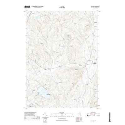
2019 Map of Hillsdale
USGS Topo · Published 2019About this map
Hillsdale and its surrounding hamlets occupy a landscape shaped by the Roeliff Jansen Kill and its various tributaries. This recent survey of Columbia County illustrates a complex network of local roads and state routes, including the Taconic State Pkwy, connecting historic settlements like Craryville and North Hillsdale. The topography is defined by several prominent rises, such as Lyon Mtn and Rheinstrom Hill, which look down upon agricultural valleys and water bodies including Copake Lake and Philmont Reservoir.
Find a feature on this map
113 named features on this map. Tap any name to fly to it.
Don’t see what you’re looking for? This feature index may not catch every label — zoom into the map to look around manually.
Map Details
Editions of this 2019 Hillsdale Map
This is the sole edition of this map. No revisions or reprints were ever made.
Other maps of this area

1885 · Sheffield
USGS Topo · 1:62,500

1888 · Sheffield
USGS Topo · 1:62,500

1888 · Pittsfield
USGS Topo · 1:62,500

1890 · Pittsfield
USGS Topo · 1:62,500

1891 · Sheffield
USGS Topo · 1:62,500

1893 · Sheffield
USGS Topo · 1:62,500

1893 · Pittsfield
USGS Topo · 1:62,500

1894 · Pittsfield
USGS Topo · 1:62,500

1897 · Pittsfield
USGS Topo · 1:62,500

1897 · Sheffield
USGS Topo · 1:62,500