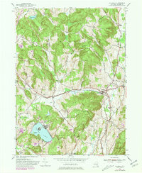
1980 Map of Hillsdale
USGS Topo · Published 1981About this map
Hillsdale and the surrounding high country of Hillsdale and Scutt Hill define this corner of Columbia County. The landscape is a mix of agricultural valleys and wooded peaks, with the New York Central railroad corridor cutting east-west through Craryville and the main settlement. Water is a central feature of the terrain, from the sprawling Copake Lake and its Mosquito Island to the winding Roeliff Jansen Kill and Agawamuck Creek. Local genealogy is well-represented through numerous family and community landmarks, including Crum Church, Williams Cem, and Niver Cem. The 1980 photorevised data, shown in purple, highlights the expansion of residential footprints and roads near the Taconic State Parkway and around Robinson Pond, reflecting the area's mid-century evolution as both a rural community and a destination for outdoor recreation.
Find a feature on this map
41 named features on this map. Tap any name to fly to it.
Don’t see what you’re looking for? This feature index may not catch every label — zoom into the map to look around manually.
Map Details
Editions of this 1980 Hillsdale Map
This is the sole edition of this map. No revisions or reprints were ever made.
Other maps of this area

1885 · Sheffield
USGS Topo · 1:62,500

1888 · Sheffield
USGS Topo · 1:62,500

1888 · Pittsfield
USGS Topo · 1:62,500

1890 · Pittsfield
USGS Topo · 1:62,500

1891 · Sheffield
USGS Topo · 1:62,500

1893 · Sheffield
USGS Topo · 1:62,500

1893 · Pittsfield
USGS Topo · 1:62,500

1894 · Pittsfield
USGS Topo · 1:62,500

1897 · Pittsfield
USGS Topo · 1:62,500

1897 · Sheffield
USGS Topo · 1:62,500