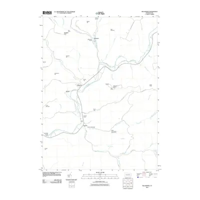
2010 Map of Hillsgrove
USGS Topo · Published 2010About this map
Hillsgrove sits as a central settlement within a landscape defined by the deep incisions of Loyalsock Creek and its many tributaries. The area is characterized by dramatic topographic relief, featuring the Loyalsock Creek Gorge and the Kettle Creek Gorge Natural Area, which highlight the erosion patterns of the Allegheny Plateau. Small clusters of habitation like Ogdonia, Plunkett, and Wissingers are scattered along the narrow valley floors, connected by winding routes such as Old Sock Rd and Covered Bridge Rd. High points like High Knob and Gooseberry Hill provide significant elevation above the stream beds, with landmarks like Hoagland Vista and the High Knob Overlook offering vantage points over the drainage basins. Significant water features including Angel Falls Waterfall and the quiet waters of Hunters Lake in the southeast corner illustrate the diverse hydrologic character of Sullivan County.
Find a feature on this map
63 named features on this map. Tap any name to fly to it.
Don’t see what you’re looking for? This feature index may not catch every label — zoom into the map to look around manually.
Map Details
Editions of this 2010 Hillsgrove Map
This is the sole edition of this map. No revisions or reprints were ever made.
Other maps of this area

1927 · Eagles Mere
USGS Topo · 1:48,000

1930 · Warrensville
USGS Topo · 1:62,500

1932 · Eagle Mere
USGS Topo · 1:62,500

1934 · Warrensville
USGS Topo · 1:62,500

1942 · Canton
USGS Topo · 1:62,500

1943 · Powell
USGS Topo · 1:62,500

1944 · Canton
USGS Topo · 1:62,500

1945 · Powell
USGS Topo · 1:62,500

1953 · Warrensville
USGS Topo · 1:62,500

1953 · Eagles Mere
USGS Topo · 1:62,500
Featured Places
- Hillsgrove Township, PA
- Elkland Township, PA
- Plunkett, Hillsgrove Township
- Fox Township, PA
- Plunketts Creek Township, PA