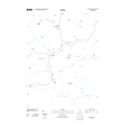
2013 Map of Hillsgrove
USGS Topo · Published 2013About this map
Loyalsock Cr defines the valley floor of this northern Pennsylvania landscape, where the small settlements of Hillsgrove and Ogdonia serve as local hubs. The terrain is marked by steep elevation changes, with named peaks such as Bear Mountain, High Knob, and Rough Hill surrounding the river corridor. Significant conservation and recreation areas are established here, including the High Knob Natural Area and the Kettle Creek Gorge Natural Area, suggesting a region dominated by state forest land and preserved wilderness. The presence of High Bridge and Hoagland Vista underscores a geography shaped by deep ravines and scenic overlooks. Moving north, smaller hamlets like Wissingers and Plunkett are situated along secondary routes like Old Sock Rd and Slab Run Rd, reflecting the sparse, isolated settlement pattern typical of Sullivan County.
Find a feature on this map
74 named features on this map. Tap any name to fly to it.
Don’t see what you’re looking for? This feature index may not catch every label — zoom into the map to look around manually.
Map Details
Editions of this 2013 Hillsgrove Map
This is the sole edition of this map. No revisions or reprints were ever made.
Other maps of this area

1927 · Eagles Mere
USGS Topo · 1:48,000

1930 · Warrensville
USGS Topo · 1:62,500

1932 · Eagle Mere
USGS Topo · 1:62,500

1934 · Warrensville
USGS Topo · 1:62,500

1942 · Canton
USGS Topo · 1:62,500

1943 · Powell
USGS Topo · 1:62,500

1944 · Canton
USGS Topo · 1:62,500

1945 · Powell
USGS Topo · 1:62,500

1953 · Warrensville
USGS Topo · 1:62,500

1953 · Eagles Mere
USGS Topo · 1:62,500
Featured Places
- Hillsgrove Township, PA
- Elkland Township, PA
- Plunkett, Hillsgrove Township
- Fox Township, PA
- Plunketts Creek Township, PA