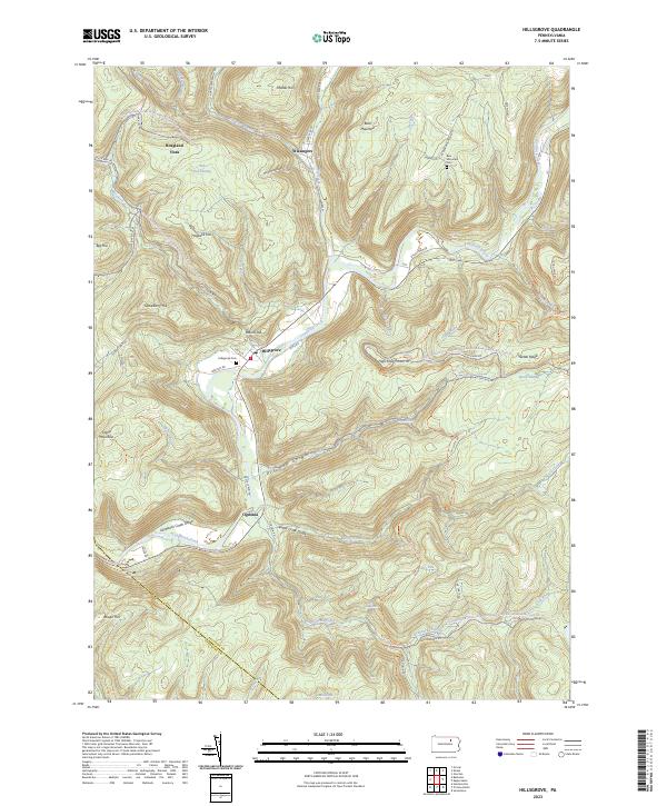
2023 Map of Hillsgrove
USGS Topo · Published 2023About this map
Hillsgrove lies at the confluence of Loyalsock Creek and Mill Creek, anchoring a landscape defined by deep watercuts and high timberlands in the central Pennsylvania wilds. This 2023 survey illustrates the rugged geography of the Loyalsock Creek Gorge and the Kettle Creek Gorge, where small settlements like Ogdonia and Wissingers sit along narrow valley floors. The map details an extensive network of recreational routes, including the Loyalsock Trl and various snowmobile trails through the Loyalsock State Forest. Local history and genealogy are preserved at sites such as Hillsgrove Cem and Bear Mountain Cem. Further up the ridges, features like Hoagland Vista and Dry Run Falls mark the dramatic change in elevation, while the naming of Coal Mine Rd near Scar Run points to the area's extraction history. The boundary between Sullivan Co and Lycoming Co cuts across the southwestern portion, tracing the height of land near Rough Hill.
Find a feature on this map
73 named features on this map. Tap any name to fly to it.
Don’t see what you’re looking for? This feature index may not catch every label — zoom into the map to look around manually.
Map Details
Editions of this 2023 Hillsgrove Map
This is the sole edition of this map. No revisions or reprints were ever made.
Other maps of this area

1927 · Eagles Mere
USGS Topo · 1:48,000

1930 · Warrensville
USGS Topo · 1:62,500

1932 · Eagle Mere
USGS Topo · 1:62,500

1934 · Warrensville
USGS Topo · 1:62,500

1942 · Canton
USGS Topo · 1:62,500

1943 · Powell
USGS Topo · 1:62,500

1944 · Canton
USGS Topo · 1:62,500

1945 · Powell
USGS Topo · 1:62,500

1953 · Warrensville
USGS Topo · 1:62,500

1953 · Eagles Mere
USGS Topo · 1:62,500
Featured Places
- Hillsgrove Township, PA
- Elkland Township, PA
- Shrewsbury Township, PA
- Ogdonia, Hillsgrove Township
- Wissingers, Fox Township