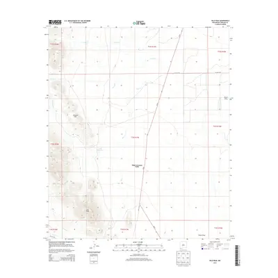
2013 Map of Hilo Peak
USGS Topo · Published 2013About this map
High Lonesome Wells serves as a lonely landmark in this high desert landscape of Hidalgo County, situated where the arid basin meets rising terrain. The area is defined by the elevation of Hilo Peak and the nearby Chinaman Hills, which overlook the expansive Playas Valley to the east. This section of the Bootheel region relies on ephemeral water sources and drainage systems including Walnut Cr, Brushy Cr, and Deer Cr, which provide the primary geographical structure for the ranching and resource territory. A single primary artery, NM-81, cuts across the map from north to south, facilitating movement through this isolated borderlands corridor. Local infrastructure is minimal, represented by features like the Little Brushy Tank and the path toward San Luis Pass, highlighting the enduring reliance on established water points and historic mountain gaps in an otherwise sparsely populated environment.
Find a feature on this map
22 named features on this map. Tap any name to fly to it.
Don’t see what you’re looking for? This feature index may not catch every label — zoom into the map to look around manually.
Map Details
Editions of this 2013 Hilo Peak Map
This is the sole edition of this map. No revisions or reprints were ever made.
Other maps of this area

1917 · Antelope Wells
USGS Topo · 1:62,500

1918 · Big Hatchet Peak
USGS Topo · 1:62,500

1918 · Dog Mountains
USGS Topo · 1:62,500

1918 · Walnut Wells
USGS Topo · 1:62,500

1919 · Antelope Wells
USGS Topo · 1:62,500

1923 · Walnut Wells
USGS Topo · 1:62,500

1955 · Douglas
USGS Topo · 1:250,000

1959 · Douglas
USGS Topo · 1:250,000

1961 · Douglas
USGS Topo · 1:250,000

1964 · Douglas
USGS Topo · 1:250,000