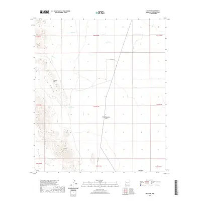
2020 Map of Hilo Peak
USGS Topo · Published 2020About this map
High Lonesome Wells stands as a central landmark in this high-desert portion of the Playas Valley, where water sources dictate the movement and settlement patterns of the region. The landscape is defined by the elevation of Hilo Peak and the Chinaman Hills to the west, which contrast sharply with the alluvial plains to the east. A network of ephemeral drainages, including Walnut Cr, Brushy Cr, and Deer Cr, channel seasonal runoff from the higher elevations toward the valley floor. Transportation through this remote terrain is marked by historical routes such as the San Luis Pass and the rugged Lard Camp Rd, reflecting the long-standing ranching and land management infrastructure of Hidalgo County. The map provides a clear record of the Public Land Survey System grid, including the intersection of multiple township and range lines that have governed boundary lines for generations.
Find a feature on this map
22 named features on this map. Tap any name to fly to it.
Don’t see what you’re looking for? This feature index may not catch every label — zoom into the map to look around manually.
Map Details
Editions of this 2020 Hilo Peak Map
This is the sole edition of this map. No revisions or reprints were ever made.
Other maps of this area

1917 · Antelope Wells
USGS Topo · 1:62,500

1918 · Big Hatchet Peak
USGS Topo · 1:62,500

1918 · Dog Mountains
USGS Topo · 1:62,500

1918 · Walnut Wells
USGS Topo · 1:62,500

1919 · Antelope Wells
USGS Topo · 1:62,500

1923 · Walnut Wells
USGS Topo · 1:62,500

1955 · Douglas
USGS Topo · 1:250,000

1959 · Douglas
USGS Topo · 1:250,000

1961 · Douglas
USGS Topo · 1:250,000

1964 · Douglas
USGS Topo · 1:250,000