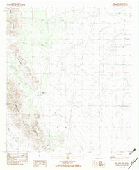
1982 Map of Hilo Peak
USGS Topo · Published 1982About this map
Hilo Peak stands as the central landmark in this southwestern corner of New Mexico, anchoring a landscape defined by the intersection of the Animas Mountains, the Chinaman Hills, and the Smuggler Hills. Surveyed in the late 1970s, this area is characterized by high-desert drainage patterns and strategic mountain gaps. The map reveals a network of intermittent waterways such as Walnut Creek, Brushy Creek, and Deer Creek, which are critical to understanding the hydrology and land use of this arid region. Human presence is marked primarily by ranching infrastructure, including Little Brushy Tank and South Tank, and the significant topographical breach at Granite Pass. The lack of dense settlement in this 1982 edition highlights the isolated, range-focused character of Hidalgo County, where water sources and mountain passes determined the routes of early travel and modern land management.
Find a feature on this map
14 named features on this map. Tap any name to fly to it.
Don’t see what you’re looking for? This feature index may not catch every label — zoom into the map to look around manually.
Map Details
Editions of this 1982 Hilo Peak Map
This is the sole edition of this map. No revisions or reprints were ever made.
Other maps of this area

1917 · Antelope Wells
USGS Topo · 1:62,500

1918 · Big Hatchet Peak
USGS Topo · 1:62,500

1918 · Dog Mountains
USGS Topo · 1:62,500

1918 · Walnut Wells
USGS Topo · 1:62,500

1919 · Antelope Wells
USGS Topo · 1:62,500

1923 · Walnut Wells
USGS Topo · 1:62,500

1955 · Douglas
USGS Topo · 1:250,000

1959 · Douglas
USGS Topo · 1:250,000

1961 · Douglas
USGS Topo · 1:250,000

1964 · Douglas
USGS Topo · 1:250,000