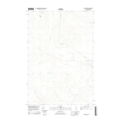
2014 Map of Hinckley Hill
USGS Topo · Published 2014About this map
Hinckley Hill rises as a central topographic point in this northern Maine landscape, characterized by a complex network of waterways that define the region's drainage. The area is dominated by the Abacotnetic Stream, which traverses the southern portion of the terrain, fed by several smaller tributaries including McDonald Brook, E Br Rainey Brook, and W Br Rainey Brook. This 2014 survey illustrates a largely uninhabited territory where human presence is primarily marked by logging and access routes like St Aurelie Rd and Brailey Brook Rd. To the north and east, the flow of Brailey Brook and Carry Brook further reveals the intricate hydrology of this Somerset County expanse, showcasing the undisturbed natural drainage patterns and relief that have long shaped the North Woods.
Find a feature on this map
10 named features on this map. Tap any name to fly to it.
Don’t see what you’re looking for? This feature index may not catch every label — zoom into the map to look around manually.
Map Details
Editions of this 2014 Hinckley Hill Map
This is the sole edition of this map. No revisions or reprints were ever made.
Other maps of this area

1954 · Baker Lake
USGS Topo · 1:62,500

1954 · St. John Pond
USGS Topo · 1:62,500

1954 · Presque Isle
USGS Topo · 1:250,000

1957 · Norris Brook
USGS Topo · 1:62,500

1957 · Hardwood Mountain
USGS Topo · 1:62,500

1958 · Presque Isle
USGS Topo · 1:250,000

1958 · Saint John Pond
USGS Topo · 1:62,500

1960 · Presque Isle
USGS Topo · 1:250,000

1962 · Baker Lake
USGS Topo · 1:62,500

1962 · Quebec
USGS Topo · 1:250,000