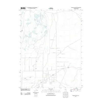
2011 Map of Hinkson Slough
USGS Topo · Published 2011About this map
Mason Valley Ranch and a series of family-held estates define this high-desert basin in Lyon County, illustrating the agricultural and ranching footprint along the eastern edge of the Mason Valley. The northern reaches are characterized by complex hydrology where the Walker River feeds into wetlands and low-lying drainages including Joggles Slough and Hinkson Slough. This landscape reveals a transition from traditional land use to modern road development, with rural residential lanes such as Tombstone Way and Pebble Beach Dr intersecting with the primary corridor of Alt 95. For the local historian, the map preserves the names of long-standing cattle operations, from the Neck Yoke Ranch to the Lazy S Ranch, situating them within the wider network of irrigation canals and sloughs that have historically sustained life in this arid region.
Find a feature on this map
29 named features on this map. Tap any name to fly to it.
Don’t see what you’re looking for? This feature index may not catch every label — zoom into the map to look around manually.
Map Details
Editions of this 2011 Hinkson Slough Map
This is the sole edition of this map. No revisions or reprints were ever made.
Other maps of this area

1891 · Wabuska
USGS Topo · 1:125,000

1891 · Wellington
USGS Topo · 1:125,000

1893 · Wellington
USGS Topo · 1:125,000

1894 · Wabuska
USGS Topo · 1:125,000

1908 · Carson Sink
USGS Topo · 1:250,000

1909 · Hawthorne
USGS Topo · 1:250,000

1910 · Carson Sink
USGS Topo · 1:250,000

1911 · Hawthorne
USGS Topo · 1:250,000

1915 · Hawthorne
USGS Topo · 1:250,000

1948 · Walker Lake
USGS Topo · 1:250,000