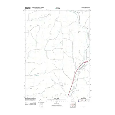
2010 Map of Hinsdale
USGS Topo · Published 2010About this map
Hinsdale and Maplehurst anchor the southeastern corner of this Cattaraugus County landscape, situated where the waters of Ischua Creek and Oil Creek converge to form Olean Creek. This topography is defined by its deep, named valleys and prominent ridges, such as Dutch Hill and Cooper Hill, which dictate the winding paths of rural thoroughfares like Hardscreabble Rd and Steward Sans Hill Rd. The map illustrates a rural economy through features like Childs Blueberry Farm near the northern border and several secluded settlements including Ischua. Local history researchers can pinpoint burial sites at the Hinsdale Cemetery and Pleasant Valley Cemetery, while also tracing the narrow hollows that provided refuge for early homesteads, including Morgan Hollow, Smith Hollow, and McClure Hollow. The proximity of these hills to the creek basins highlights the enduring importance of the valley floors for transportation and habitation in Western New York.
Find a feature on this map
58 named features on this map. Tap any name to fly to it.
Don’t see what you’re looking for? This feature index may not catch every label — zoom into the map to look around manually.
Map Details
Editions of this 2010 Hinsdale Map
This is the sole edition of this map. No revisions or reprints were ever made.
Other maps of this area

1898 · Olean
USGS Topo · 1:62,500

1900 · Salamanca
USGS Topo · 1:62,500

1924 · Ellicottville
USGS Topo · 1:62,500

1924 · Franklinville
USGS Topo · 1:62,500

1938 · Salamanca
USGS Topo · 1:62,500

1938 · Olean
USGS Topo · 1:62,500

1941 · Ellicottville
USGS Topo · 1:62,500

1942 · Franklinville
USGS Topo · 1:62,500

1943 · Olean
USGS Topo · 1:62,500

1943 · Salamanca
USGS Topo · 1:62,500