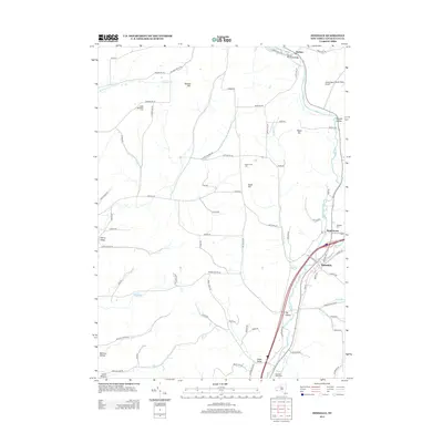
2013 Map of Hinsdale
USGS Topo · Published 2013About this map
Hinsdale and Maplehurst anchor the southeastern corner of this landscape, situated at the confluence of several key waterways and travel routes. In the early 21st century, the area remains defined by its deep valley bottoms and named hills, such as Dutch Hill and Bozard Hill, which separate the various settlements. The presence of the Cattaraugus County-Olean Airport in the northeast near Ischua signals the modernization of the local transport infrastructure, while the Baxter Mill Road Bridge serves as a bridge to the past along Ischua Cr. Numerous cemeteries, including Hinsdale Cem, Maple Grove Cem, and Pleasant Valley Cem, provide essential anchor points for genealogical research. The map captures a mix of traditional agricultural land use, seen at Childs Blueberry Farm, and small clusters of homes in Union Valley and Cherry Valley.
Find a feature on this map
77 named features on this map. Tap any name to fly to it.
Don’t see what you’re looking for? This feature index may not catch every label — zoom into the map to look around manually.
Map Details
Editions of this 2013 Hinsdale Map
This is the sole edition of this map. No revisions or reprints were ever made.
Other maps of this area

1898 · Olean
USGS Topo · 1:62,500

1900 · Salamanca
USGS Topo · 1:62,500

1924 · Ellicottville
USGS Topo · 1:62,500

1924 · Franklinville
USGS Topo · 1:62,500

1938 · Salamanca
USGS Topo · 1:62,500

1938 · Olean
USGS Topo · 1:62,500

1941 · Ellicottville
USGS Topo · 1:62,500

1942 · Franklinville
USGS Topo · 1:62,500

1943 · Olean
USGS Topo · 1:62,500

1943 · Salamanca
USGS Topo · 1:62,500