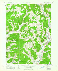
1961 Map of Hinsdale
USGS Topo · Published 1963About this map
Ischua Creek and Oil Creek converge in this corner of Cattaraugus County, shaping a landscape defined by narrow valleys and significant transport corridors. The settlement of Hinsdale serves as a central hub where the Pennsylvania Railroad and Erie Lackawanna Railroad run parallel through the valley floor, alongside roads like Pennsylvania Road and Back Hinsdale Road. This confluence of rail and water supported small communities such as Maplehurst and Jollytown during the early 1960s.
Find a feature on this map
55 named features on this map. Tap any name to fly to it.
Don’t see what you’re looking for? This feature index may not catch every label — zoom into the map to look around manually.
Map Details
Editions of this 1961 Hinsdale Map
This is the sole edition of this map. No revisions or reprints were ever made.
Other maps of this area

1898 · Olean
USGS Topo · 1:62,500

1900 · Salamanca
USGS Topo · 1:62,500

1924 · Ellicottville
USGS Topo · 1:62,500

1924 · Franklinville
USGS Topo · 1:62,500

1938 · Salamanca
USGS Topo · 1:62,500

1938 · Olean
USGS Topo · 1:62,500

1941 · Ellicottville
USGS Topo · 1:62,500

1942 · Franklinville
USGS Topo · 1:62,500

1943 · Olean
USGS Topo · 1:62,500

1943 · Salamanca
USGS Topo · 1:62,500