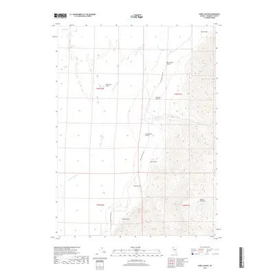
2018 Map of Hobo Canyon
USGS Topo · Published 2018About this map
The Black Rock Desert floor meets the sharp rising slopes of the Jackson Mountains in this Humboldt County landscape. This 2018 survey captures the intricate drainage system where the Quinn River and the Jackson Cr Slough meander across the arid flats. The eastern half of the map is defined by a series of dramatic geographic features, including Hobo Canyon, Alaska Canyon, and Mike O'Brian Canyon, which cut through the steep mountain terrain. The only significant human infrastructure noted is the Jackson Creek Ranch Rd, which skirts the base of the mountains. This map serves as an essential record of the hydrology and topography in a region where seasonal water flow, such as Jackson Cr and Mary Sloan Cr, dictates the movement of both people and wildlife across the desert basin.
Find a feature on this map
18 named features on this map. Tap any name to fly to it.
Don’t see what you’re looking for? This feature index may not catch every label — zoom into the map to look around manually.
Map Details
Editions of this 2018 Hobo Canyon Map
This is the sole edition of this map. No revisions or reprints were ever made.
Other maps of this area

1886 · Disaster
USGS Topo · 1:250,000

1893 · Disaster
USGS Topo · 1:250,000

1954 · Vya
USGS Topo · 1:250,000

1958 · Vya
USGS Topo · 1:250,000

1961 · Bottle Creek
USGS Topo · 1:62,500

1962 · Vya
USGS Topo · 1:250,000

1966 · Donna Schee Peak
USGS Topo · 1:62,500

1966 · King Lear Peak
USGS Topo · 1:62,500

1972 · Deer Creek Slough
USGS Topo · 1:24,000

1972 · Hobo Canyon
USGS Topo · 1:24,000