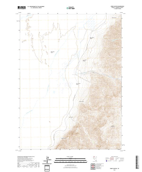
2021 Map of Hobo Canyon
USGS Topo · Published 2021About this map
The Quinn River skims the northern boundary of this high-desert landscape, where the flat alkaline expanse of the Black Rock Desert meets the steep western face of the Jackson Mountains. This map documents a transitional zone defined by dramatic elevation changes, where seasonal drainages like Mary Sloan Cr and Jackson Cr descend through deep clefts such as Mike O'Brian Canyon and Christiorsson Canyon. The presence of Jackson Creek Ranch Rd serves as the primary artery through this arid region, tracing the base of the mountains to connect remote ranching sites. To the west, the Jackson Cr Slough meanders across the playa, illustrating the complex hydrology of the Great Basin where water from Hobo Canyon and Alaska Canyon eventually loses its definition in the desert floor.
Find a feature on this map
18 named features on this map. Tap any name to fly to it.
Don’t see what you’re looking for? This feature index may not catch every label — zoom into the map to look around manually.
Map Details
Editions of this 2021 Hobo Canyon Map
This is the sole edition of this map. No revisions or reprints were ever made.
Other maps of this area

1886 · Disaster
USGS Topo · 1:250,000

1893 · Disaster
USGS Topo · 1:250,000

1954 · Vya
USGS Topo · 1:250,000

1958 · Vya
USGS Topo · 1:250,000

1961 · Bottle Creek
USGS Topo · 1:62,500

1962 · Vya
USGS Topo · 1:250,000

1966 · Donna Schee Peak
USGS Topo · 1:62,500

1966 · King Lear Peak
USGS Topo · 1:62,500

1972 · Deer Creek Slough
USGS Topo · 1:24,000

1972 · Hobo Canyon
USGS Topo · 1:24,000