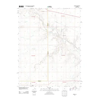
2013 Map of Hobson
USGS Topo · Published 2013About this map
The Arkansas River carves through the center of this landscape, marking the topographic transition where the high plains meet the eastern slopes of the Rockies. The settlement of Hobson sits along the river's path, served by complex water management infrastructure including the Hobson Ditch and the extensive Minnequa Canal, which winds southward across the terrain. To the south, the community of Siloam is positioned near the junction of Siloam Rd and Red Cr. This map reveals a rugged land shaped by seasonal drainage, with numerous dry gulches and creeks like Fred Rohr Gulch and Little Red Cr feeding into the primary river valley. The county line between Fremont Co and Pueblo Co bisects the area, illustrating the administrative boundaries that define this portion of the Arkansas River basin.
Find a feature on this map
26 named features on this map. Tap any name to fly to it.
Don’t see what you’re looking for? This feature index may not catch every label — zoom into the map to look around manually.
Map Details
Editions of this 2013 Hobson Map
This is the sole edition of this map. No revisions or reprints were ever made.
Other maps of this area

1889 · Canon City
USGS Topo · 1:125,000

1891 · Pueblo
USGS Topo · 1:125,000

1892 · Canon City
USGS Topo · 1:125,000

1894 · Pueblo
USGS Topo · 1:125,000

1896 · Pueblo
USGS Topo · 1:125,000

1897 · Pueblo
USGS Topo · 1:125,000

1954 · Pueblo
USGS Topo · 1:250,000

1957 · Pueblo
USGS Topo · 1:250,000

1958 · Pueblo
USGS Topo · 1:250,000

1959 · Florence
USGS Topo · 1:24,000