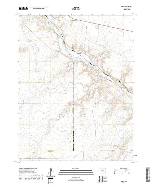
2022 Map of Hobson
USGS Topo · Published 2022About this map
The Arkansas River carves a deep valley through this high-plains landscape on the border of Fremont and Pueblo counties. Water management defines the settlement pattern here, with the Minnequa Canal and Hobson Ditch diverting the river's flow to support the semi-arid region's needs. The small community of Hobson sits near the confluence of several drainages, including Fred Rohr Gulch and Richie Gulch, while the settlement of Siloam is tucked into the southwestern corner of the quadrangle. For those studying the geography of the Arkansas Valley, the map documents the transition from the river's riparian corridor to the dissected uplands marked by ephemeral streams like Willow Spring Cr and Little Red Cr. Trails such as the Pueblo Res River Access Northwest Trl indicate the area's modern utility for recreation, even as the landscape retains its rural character through traditional property boundaries.
Find a feature on this map
27 named features on this map. Tap any name to fly to it.
Don’t see what you’re looking for? This feature index may not catch every label — zoom into the map to look around manually.
Map Details
Editions of this 2022 Hobson Map
This is the sole edition of this map. No revisions or reprints were ever made.
Other maps of this area

1889 · Canon City
USGS Topo · 1:125,000

1891 · Pueblo
USGS Topo · 1:125,000

1892 · Canon City
USGS Topo · 1:125,000

1894 · Pueblo
USGS Topo · 1:125,000

1896 · Pueblo
USGS Topo · 1:125,000

1897 · Pueblo
USGS Topo · 1:125,000

1954 · Pueblo
USGS Topo · 1:250,000

1957 · Pueblo
USGS Topo · 1:250,000

1958 · Pueblo
USGS Topo · 1:250,000

1959 · Florence
USGS Topo · 1:24,000