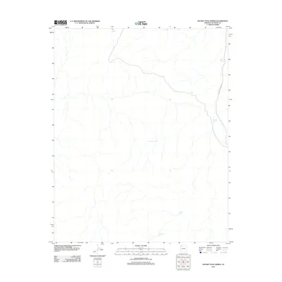
2011 Map of Hockey Puck Spring
USGS Topo · Published 2011About this map
Hockey Puck Spring defines this remote stretch of Coconino County, serving as a critical water source in a landscape primarily shaped by hydrologic features and ranching infrastructure. The map reveals a network of managed water points essential for livestock and local wildlife, including Mexican Tank, Oak Tank, and Twin Tanks. The inclusion of the D S Ranch Tank suggests the area's agricultural history and the practicalities of ranching in this arid environment. Transportation through this section of Arizona is facilitated by Indian Service Road 18, which provides the primary access route across the eastern portion of the quadrangle. Other notable water features like Big Spring and Prospect Tank further illustrate the importance of water management in this specific geographic context during the early 21st century.
Find a feature on this map
8 named features on this map. Tap any name to fly to it.
Don’t see what you’re looking for? This feature index may not catch every label — zoom into the map to look around manually.
Map Details
Editions of this 2011 Hockey Puck Spring Map
This is the sole edition of this map. No revisions or reprints were ever made.
Other maps of this area

1886 · Diamond Creek
USGS Topo · 1:250,000

1886 · Mt. Trumbull
USGS Topo · 1:250,000

1892 · Diamond Creek
USGS Topo · 1:250,000

1892 · Mt. Trumbull
USGS Topo · 1:250,000

1948 · Williams
USGS Topo · 1:250,000

1953 · Grand Canyon
USGS Topo · 1:250,000

1954 · Williams
USGS Topo · 1:250,000

1956 · Williams
USGS Topo · 1:250,000

1957 · Grand Canyon
USGS Topo · 1:250,000

1958 · Grand Canyon
USGS Topo · 1:250,000