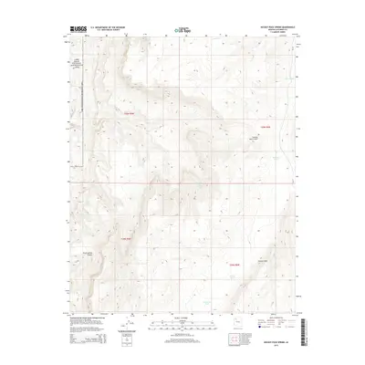
2014 Map of Hockey Puck Spring
USGS Topo · Published 2014About this map
Lake Mead National Recreation Area occupies the western edge of this landscape, where the high desert meets the protected canyonlands of Coconino County. The topography is dominated by the dramatic elevation changes of the Aubrey Cliffs and the deep incisions of Granite Park Canyon and Three Springs Canyon. Settlement is absent, replaced by a sparse network of water improvements essential for land management and ranching. These include Big Spring and Hockey Puck Spring, alongside several man-made reservoirs like Prospect Tank, Mexican Tank, and D S Ranch Tank. The inclusion of Bia-10 indicates the vital role of Bureau of Indian Affairs routes in accessing these high-plateau reaches, connecting isolated water sources across the township and range divisions.
Find a feature on this map
18 named features on this map. Tap any name to fly to it.
Don’t see what you’re looking for? This feature index may not catch every label — zoom into the map to look around manually.
Map Details
Editions of this 2014 Hockey Puck Spring Map
This is the sole edition of this map. No revisions or reprints were ever made.
Other maps of this area

1886 · Diamond Creek
USGS Topo · 1:250,000

1886 · Mt. Trumbull
USGS Topo · 1:250,000

1892 · Diamond Creek
USGS Topo · 1:250,000

1892 · Mt. Trumbull
USGS Topo · 1:250,000

1948 · Williams
USGS Topo · 1:250,000

1953 · Grand Canyon
USGS Topo · 1:250,000

1954 · Williams
USGS Topo · 1:250,000

1956 · Williams
USGS Topo · 1:250,000

1957 · Grand Canyon
USGS Topo · 1:250,000

1958 · Grand Canyon
USGS Topo · 1:250,000