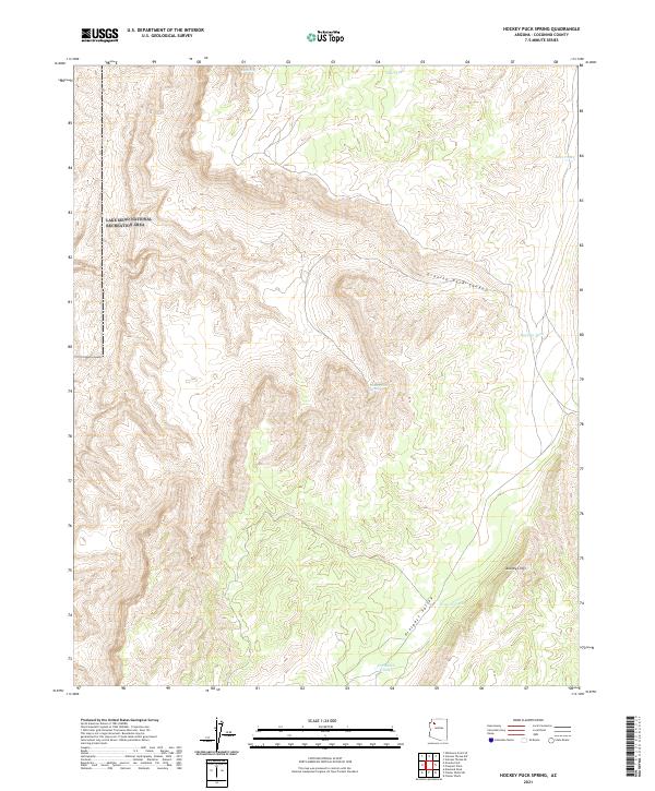
2021 Map of Hockey Puck Spring
USGS Topo · Published 2021About this map
The Lake Mead National Recreation Area occupies the northwestern corner of this territory, where the terrain is defined by the dramatic descent of Granite Park Canyon. This 2021 landscape is characterized by its essential water sources, including the curiously named Hockey Puck Spring and the Big Spring. These water points, along with various man-made reservoirs like D S Ranch Tank and Mexican Tank, suggest a land managed for cattle and conservation in a dry climate. To the east, the Aubrey Cliffs rise above Prospect Valley, marking a significant geological boundary that has historically dictated movement and land use in this part of Coconino County. The survey details the Public Land Survey System township and range lines, such as t30n r9w, which continue to define property and administrative boundaries in this remote high-desert environment.
Find a feature on this map
15 named features on this map. Tap any name to fly to it.
Don’t see what you’re looking for? This feature index may not catch every label — zoom into the map to look around manually.
Map Details
Editions of this 2021 Hockey Puck Spring Map
This is the sole edition of this map. No revisions or reprints were ever made.
Other maps of this area

1886 · Diamond Creek
USGS Topo · 1:250,000

1886 · Mt. Trumbull
USGS Topo · 1:250,000

1892 · Diamond Creek
USGS Topo · 1:250,000

1892 · Mt. Trumbull
USGS Topo · 1:250,000

1948 · Williams
USGS Topo · 1:250,000

1953 · Grand Canyon
USGS Topo · 1:250,000

1954 · Williams
USGS Topo · 1:250,000

1956 · Williams
USGS Topo · 1:250,000

1957 · Grand Canyon
USGS Topo · 1:250,000

1958 · Grand Canyon
USGS Topo · 1:250,000