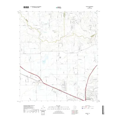
2019 Map of Hockley
USGS Topo · Published 2019About this map
Hockley serves as the primary settlement hub in this northwestern reach of the Houston metropolitan area, where the coastal prairie begins to transition toward the creek-fed woodlands of the interior. The landscape is defined by its complex drainage network, featuring Spring Cr along the northern border and the meandering Little Cypress Cr to the south. Historically significant family names are preserved throughout the survey, from the Hegar Brothers Lake and Southard Lake to the scattered pioneer-era resting places such as Macedonia Cem, Hegar Cem, and Roberts Cem. The transportation infrastructure follows established corridors like FM 2920 and Old Washington Rd, reflecting the area's development from a rural rail stop into a modern residential and ranching community, anchored by landmarks like the Diamond N Ranch Airport.
Find a feature on this map
124 named features on this map. Tap any name to fly to it.
Don’t see what you’re looking for? This feature index may not catch every label — zoom into the map to look around manually.
Map Details
Editions of this 2019 Hockley Map
This is the sole edition of this map. No revisions or reprints were ever made.
Other maps of this area

1915 · Cypress
USGS Topo · 1:24,000

1916 · Rose Hill
USGS Topo · 1:24,000

1916 · Hockley
USGS Topo · 1:24,000

1916 · Swanson
USGS Topo · 1:24,000

1918 · Cypress
USGS Topo · 1:31,680

1919 · Swanson
USGS Topo · 1:31,680

1920 · Hockley
USGS Topo · 1:31,680

1920 · Rose Hill
USGS Topo · 1:31,680

1920 · Waller
USGS Topo · 1:31,680

1950 · Houston
USGS Topo · 1:250,000