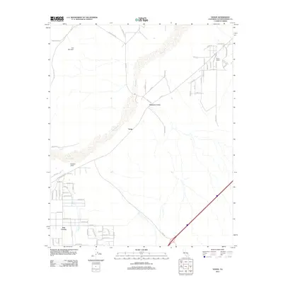
2012 Map of Hodge
USGS Topo · Published 2012About this map
The Mojave River defines the corridor of this High Desert landscape, its wide sandy bed flanked by the small settlements of Hodge and Johnstons Corner. During the early 21st century, the area maintained its character as a sparse crossroads where historical transport routes converge. The National Trails Hwy, a remnant of the legendary Route 66, parallels the river and local rail lines, connecting the community to larger hubs like Barstow. To the northwest, the prominent rising of Iron Mountain breaks the desert floor, while the southern reaches near Wild Crossing are marked by the seasonal drainage of Wild Wash. Mapping includes local aviation landmarks like Depue Airport and a network of desert tracks and residential streets such as Old Hinkley Rd and Main St.
Find a feature on this map
65 named features on this map. Tap any name to fly to it.
Don’t see what you’re looking for? This feature index may not catch every label — zoom into the map to look around manually.
Map Details
Editions of this 2012 Hodge Map
This is the sole edition of this map. No revisions or reprints were ever made.
Other maps of this area

1932 · Barstow
USGS Topo · 1:125,000

1934 · Barstow
USGS Topo · 1:125,000

1953 · San Bernardino
USGS Topo · 1:250,000

1956 · San Bernardino
USGS Topo · 1:250,000

1956 · Hawes
USGS Topo · 1:62,500

1956 · Barstow
USGS Topo · 1:62,500

1956 · Helendale
USGS Topo · 1:24,000
1956 · Victorville
USGS Topo · 1:62,500

1957 · Apple Valley
USGS Topo · 1:62,500

1957 · San Bernardino
USGS Topo · 1:250,000