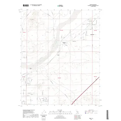
2018 Map of Hodge
USGS Topo · Published 2018About this map
Hodge and Johnstons Corner anchor this arid landscape along the Mojave River, where modern transportation routes parallel the historic path of water through the Mojave Desert. The map reveals a dense network of desert tracks and roads with evocative names like Chisholm Trl, Stage Coach Trl, and Bonanza Trl, reflecting the region's enduring frontier character. The western edge of Barstow appears in the northeast, marking the transition from urban outskirts to the broad alluvial plains of Brisbane Valley.
Find a feature on this map
71 named features on this map. Tap any name to fly to it.
Don’t see what you’re looking for? This feature index may not catch every label — zoom into the map to look around manually.
Map Details
Editions of this 2018 Hodge Map
This is the sole edition of this map. No revisions or reprints were ever made.
Other maps of this area

1932 · Barstow
USGS Topo · 1:125,000

1934 · Barstow
USGS Topo · 1:125,000

1953 · San Bernardino
USGS Topo · 1:250,000

1956 · San Bernardino
USGS Topo · 1:250,000

1956 · Hawes
USGS Topo · 1:62,500

1956 · Barstow
USGS Topo · 1:62,500

1956 · Helendale
USGS Topo · 1:24,000
1956 · Victorville
USGS Topo · 1:62,500

1957 · Apple Valley
USGS Topo · 1:62,500

1957 · San Bernardino
USGS Topo · 1:250,000