
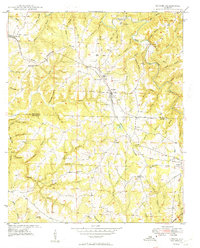
1949 Map of Hodges
USGS Topo · Published 1949About this map
The Tennessee Valley Divide snakes across the landscape of northwest Alabama, separating the complex drainages that feed into Bear Creek. In the late 1940s, the Illinois Central railroad served as a central artery for the region, passing through the town of Hodges and the smaller settlement of Atwood. This survey, compiled from aerial photography and ground-level mapping, documents a rural society defined by small community hubs and family-named landmarks. Numerous country churches and burial grounds, such as Holly Spring Ch, Mt Zion Ch, and the Lawler Cem, are scattered throughout the hills. The map highlights the localized infrastructure of the era, from the Hodges Sch to the Railroad Pond, and the various water crossings like Scott Bridge and Jim Williams Ford that connected these disparate homesteads across the many branches of Bull Mountain Creek.
Find a feature on this map
68 named features on this map. Tap any name to fly to it.
Don’t see what you’re looking for? This feature index may not catch every label — zoom into the map to look around manually.
Map Details
Editions of this 1949 Hodges Map
2 editions found
Other maps of this area

1936 · Hodges
USGS Topo · 1:24,000

1936 · Isbell
USGS Topo · 1:24,000

1936 · South Of Hackleburg
USGS Topo · 1:24,000

1936 · Hackleburg
USGS Topo · 1:24,000

1936 · Vina
USGS Topo · 1:24,000

1936 · Halltown
USGS Topo · 1:24,000

1936 · Guinn Cross Roads
USGS Topo · 1:24,000
1945 · Isbell
USGS Topo · 1:24,000

1946 · Hackleburg
USGS Topo · 1:24,000
1946 · Guinn Cross Roads
USGS Topo · 1:24,000