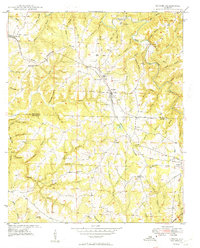
1949 Map of Hodges
USGS Topo · Published 1949About this map
The Tennessee Valley Divide snakes through this 1949 survey of the Alabama uplands, marking a distinct geographical boundary where the drainage systems of the north and south part ways. The settlement of Hodges serves as a central hub, situated along the Illinois Central Railroad and surrounded by a dense network of family-named watercourses such as McKelly Spring Br and Hulsey Branch.
Find a feature on this map
78 named features on this map. Tap any name to fly to it.
Don’t see what you’re looking for? This feature index may not catch every label — zoom into the map to look around manually.
Map Details
Editions of this 1949 Hodges Map
2 editions found

Other maps of this area

1936 · Hodges
USGS Topo · 1:24,000

1936 · Isbell
USGS Topo · 1:24,000

1936 · South Of Hackleburg
USGS Topo · 1:24,000

1936 · Hackleburg
USGS Topo · 1:24,000

1936 · Vina
USGS Topo · 1:24,000

1936 · Halltown
USGS Topo · 1:24,000

1936 · Guinn Cross Roads
USGS Topo · 1:24,000
1945 · Isbell
USGS Topo · 1:24,000

1946 · Hackleburg
USGS Topo · 1:24,000
1946 · Guinn Cross Roads
USGS Topo · 1:24,000