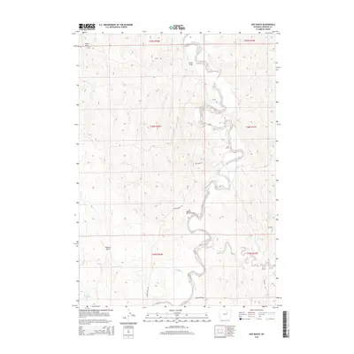
2015 Map of Hoe Ranch
USGS Topo · Published 2015About this map
The Powder River snakes through this high-plains landscape in Johnson County, anchoring a terrain defined by deep erosional draws and seasonal water sources. Central to the area is the Hoe Ranch, a namesake landmark situated near the tight bends of the river, where Hoe Spring provided a reliable water source for early settlement and ranching operations. The surrounding land is marked by a complex network of named drainage features, including Hynes Draw, Curtis Draw, and School Section Draw, which illustrate the region's topographical drainage patterns. To the south, the Reculusa Reservoir and the confluence of Ninemile Cr with the main river channel highlight the management of water in this semi-arid environment. Ranch roads like Falxa RD and Lower Sussex RD provide the primary access to these isolated pastures and homesteads.
Find a feature on this map
21 named features on this map. Tap any name to fly to it.
Don’t see what you’re looking for? This feature index may not catch every label — zoom into the map to look around manually.
Map Details
Editions of this 2015 Hoe Ranch Map
This is the sole edition of this map. No revisions or reprints were ever made.
Other maps of this area

1953 · Hoe Ranch
USGS Topo · 1:24,000

1953 · Fort Reno
USGS Topo · 1:24,000

1953 · Fort Reno SE
USGS Topo · 1:24,000

1953 · The Nipple
USGS Topo · 1:24,000

1955 · Sheridan
USGS Topo · 1:250,000

1955 · Arminto
USGS Topo · 1:250,000

1958 · Sheridan
USGS Topo · 1:250,000

1958 · Arminto
USGS Topo · 1:250,000

1961 · Soldier Creek
USGS Topo · 1:24,000

1961 · Provence Ranch
USGS Topo · 1:24,000