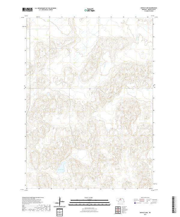
2021 Map of Hofeld Lake
USGS Topo · Published 2021About this map
Hofeld Lake serves as a prominent landmark in this section of the Nebraska Sandhills, located within the township boundaries of t28n r22w. The landscape is defined by the winding course of Long Pine Cr, which flows through the eastern portion of the quadrangle. This 2021 survey illustrates the characteristic drainage patterns and intricate topography of Brown County, where seasonal wetlands and small basins dot the terrain. The map provides a precise layout of the Public Land Survey System, including the intersection of t29n r21w and surrounding sections, offering a clear record of land divisions in this rural prairie environment.
Find a feature on this map
6 named features on this map. Tap any name to fly to it.
Don’t see what you’re looking for? This feature index may not catch every label — zoom into the map to look around manually.
Map Details
Editions of this 2021 Hofeld Lake Map
This is the sole edition of this map. No revisions or reprints were ever made.
Other maps of this area

1954 · Ainsworth SW
USGS Topo · 1:24,000

1954 · Ainsworth
USGS Topo · 1:24,000

1954 · Long Pine
USGS Topo · 1:24,000

1955 · O'Neill
USGS Topo · 1:250,000

1959 · O'Neill
USGS Topo · 1:250,000

1969 · O'Neill
USGS Topo · 1:250,000

1982 · Lost Lake Ranch
USGS Topo · 1:24,000

1982 · Hofeld Lake
USGS Topo · 1:24,000

1982 · Raven
USGS Topo · 1:24,000
1982 · Raven SW
USGS Topo · 1:24,000