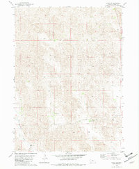
1982 Map of Raven SW
USGS Topo · Published 1982About this map
The Calamus River meanders across the southwestern corner of this Nebraska Sandhills landscape, providing a vital water source for the isolated cattle operations that define the region. In the early 1980s, the area remained a sparse network of established family-run holdings, including the Lewis Ranch, Clark Ranch, and Chase Ranch. The terrain is characterized by the complex, undulating dune topography typical of Brown County, where the placement of a Flowing Well or a standard Well often dictated the location of ranch headquarters like the Smith Ranch and Daniels Ranch. This survey documents a working ranching economy reliant on these few named landmarks and the winding river to navigate an otherwise uniform and expansive prairie environment.
Find a feature on this map
10 named features on this map. Tap any name to fly to it.
Don’t see what you’re looking for? This feature index may not catch every label — zoom into the map to look around manually.
Map Details
Editions of this 1982 Raven SW Map
This is the sole edition of this map. No revisions or reprints were ever made.
Other maps of this area

1949 · Koshopah
USGS Topo · 1:62,500

1951 · Moon Lake
USGS Topo · 1:62,500

1951 · Koshopah
USGS Topo · 1:62,500

1955 · O'Neill
USGS Topo · 1:250,000

1957 · Valentine
USGS Topo · 1:250,000

1959 · Valentine
USGS Topo · 1:250,000

1959 · O'Neill
USGS Topo · 1:250,000

1969 · O'Neill
USGS Topo · 1:250,000

1982 · Lost Lake Ranch
USGS Topo · 1:24,000

1982 · Hofeld Lake
USGS Topo · 1:24,000