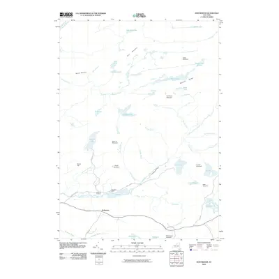
2010 Map of Hoffmeister
USGS Topo · Published 2010About this map
Hoffmeister and the surrounding Adirondack wilderness appear here in the first decade of the 21st century, defined by a dense network of high-elevation water bodies and the peaks of the Metcalf Range. The settlement of Mountain Home and the nearby Spruce Hill Cemetery offer specific points of interest for those tracing local lineages or the footprint of early mountain outposts. The landscape is dominated by the South Branch West Canada Creek, which winds through the southern portion of the quadrangle near The Floe, while higher elevations are marked by the Metcalf Chain of Lakes and solitary peaks like Wilmurt Mountain and Signal Mountain. Roads such as Mountain Home Rd and Pine Lake Rd provide the primary access into these woods, connecting the small clearings to the larger water systems of Pine Lake and Wilmurt Lake.
Find a feature on this map
52 named features on this map. Tap any name to fly to it.
Don’t see what you’re looking for? This feature index may not catch every label — zoom into the map to look around manually.
Map Details
Editions of this 2010 Hoffmeister Map
This is the sole edition of this map. No revisions or reprints were ever made.
Other maps of this area

1900 · Canada Lake
USGS Topo · 1:62,500

1900 · Wilmurt
USGS Topo · 1:62,500

1901 · Old Forge
USGS Topo · 1:62,500

1902 · Wilmurt
USGS Topo · 1:62,500

1903 · West Canada Lakes
USGS Topo · 1:62,500

1904 · Piseco Lake
USGS Topo · 1:62,500

1906 · Piseco Lake
USGS Topo · 1:62,500

1908 · Piseco Lake
USGS Topo · 1:62,500

1950 · Utica
USGS Topo · 1:250,000
1954 · Ohio
USGS Topo · 1:62,500