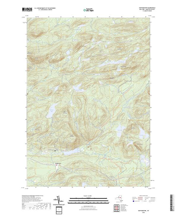
2023 Map of Hoffmeister
USGS Topo · Published 2023About this map
Hoffmeister serves as the primary gateway to a landscape defined by an intricate network of highland waters and peaks within the Adirondacks. The terrain is characterized by numerous glacial lakes and wetlands, including the Metcalf Chain of Lakes and the expansive Wilmurt Lake. These water bodies are connected by a system of drainages such as Metcalf Brook and the South Branch West Canada Creek, carving through the elevations of the Metcalf Range and Spruce Mountain.
Find a feature on this map
56 named features on this map. Tap any name to fly to it.
Don’t see what you’re looking for? This feature index may not catch every label — zoom into the map to look around manually.
Map Details
Editions of this 2023 Hoffmeister Map
This is the sole edition of this map. No revisions or reprints were ever made.
Other maps of this area

1900 · Canada Lake
USGS Topo · 1:62,500

1900 · Wilmurt
USGS Topo · 1:62,500

1901 · Old Forge
USGS Topo · 1:62,500

1902 · Wilmurt
USGS Topo · 1:62,500

1903 · West Canada Lakes
USGS Topo · 1:62,500

1904 · Piseco Lake
USGS Topo · 1:62,500

1906 · Piseco Lake
USGS Topo · 1:62,500

1908 · Piseco Lake
USGS Topo · 1:62,500

1950 · Utica
USGS Topo · 1:250,000
1954 · Ohio
USGS Topo · 1:62,500