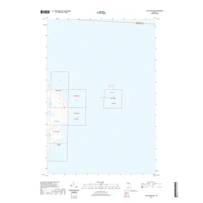
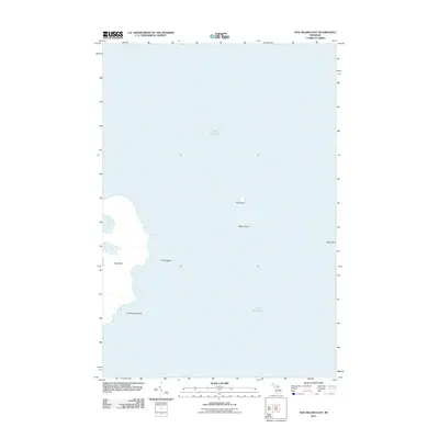
2019 Map of Hog Island East
USGS Topo · Published 2019About this map
Hog Island and its surrounding archipelago define this isolated aquatic landscape in Lake Michigan. This 2019 survey captures the varied shorelines and natural coves of the Beaver Island archipelago, notably the recessed Fisherman Bay. The map highlights a remote string of smaller landmasses, including the distinctively named Hat Island, Shoe Island, and the curved shoreline of Horseshoe Island. Smaller outcrops like Tims Island are documented alongside the political boundary between Mackinac and Charlevoix counties. The map serves as a contemporary record of these undeveloped islands, showing the intricate natural geography of the northern lake without the intrusion of modern road networks or settlements.
Find a feature on this map
12 named features on this map. Tap any name to fly to it.
Don’t see what you’re looking for? This feature index may not catch every label — zoom into the map to look around manually.
Map Details
Editions of this 2019 Hog Island East Map
This is the sole edition of this map. No revisions or reprints were ever made.
Other maps of this area

1955 · Hog Island
USGS Topo · 1:62,500

1955 · Cheboygan
USGS Topo · 1:250,000

1958 · Cheboygan
USGS Topo · 1:250,000

1958 · Cross Village
USGS Topo · 1:62,500

1984 · Beaver Island
USGS Topo · 1:100,000
1986 · Hog Island West
USGS Topo · 1:24,000
1986 · Hog Island East
USGS Topo · 1:24,000

2011 · Beaver Island North OE E
USGS Topo · 1:24,000
2011 · Hog Island West
USGS Topo · 1:24,000
2011 · Hog Island East
USGS Topo · 1:24,000