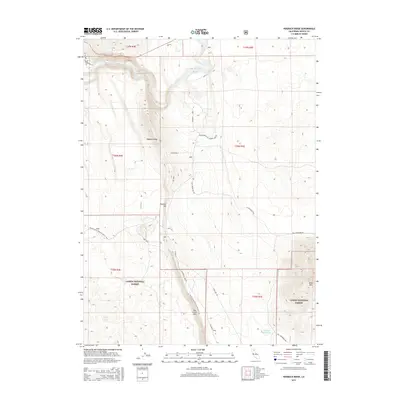
2015 Map of Hogback Ridge
USGS Topo · Published 2015About this map
Lassen National Forest terrain dominates this corner of Shasta County, defined by the dramatic volcanic and riverine geography of Northern California. The Pit River flows through the northern reaches of the quadrangle, punctuated by the Pit River Falls near Powerhouse Rd. To the south, the topography rises sharply toward the Hat Creek Rim, a significant basaltic escarpment that provides a clear boundary for the local drainage basins and the Antelope Reservoir.
Find a feature on this map
27 named features on this map. Tap any name to fly to it.
Don’t see what you’re looking for? This feature index may not catch every label — zoom into the map to look around manually.
Map Details
Editions of this 2015 Hogback Ridge Map
This is the sole edition of this map. No revisions or reprints were ever made.
Other maps of this area

1886 · Lassen Peak
USGS Topo · 1:250,000

1886 · Modoc Lava Bed
USGS Topo · 1:250,000

1892 · Modoc Lava-Bed
USGS Topo · 1:250,000

1892 · Lassen Peak
USGS Topo · 1:250,000

1894 · Lassen Peak
USGS Topo · 1:250,000

1932 · Bartle
USGS Topo · 1:96,000

1935 · Burney
USGS Topo · 1:96,000

1939 · Burney
USGS Topo · 1:125,000

1939 · Halls Flat
USGS Topo · 1:125,000

1939 · Bartle
USGS Topo · 1:125,000