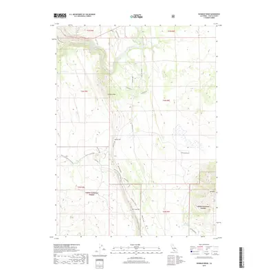
2018 Map of Hogback Ridge
USGS Topo · Published 2018About this map
Lassen National Forest terrain dominates this Shasta County map, where the winding Pit River carves through the northern section of the quadrangle. The landscape is defined by significant volcanic and tectonic features, most notably the towering Hat Creek Rim and Hogback Ridge. For those tracing the evolution of outdoor recreation and public land management in the twenty-first century, the map details the path of the Pacific Crest National Scenic Trail as it traverses the western slopes. Evidence of utility infrastructure and historical management is scattered across the high country, including the Pole Line Rd corridor and the site of Old Headquarters near the Antelope Reservoir. The network of forest routes, such as St John Ranch Rd and Cassel Fall River Road, provides insight into how this corner of the Cascades has been accessed for timber and fire management.
Find a feature on this map
30 named features on this map. Tap any name to fly to it.
Don’t see what you’re looking for? This feature index may not catch every label — zoom into the map to look around manually.
Map Details
Editions of this 2018 Hogback Ridge Map
This is the sole edition of this map. No revisions or reprints were ever made.
Other maps of this area

1886 · Lassen Peak
USGS Topo · 1:250,000

1886 · Modoc Lava Bed
USGS Topo · 1:250,000

1892 · Modoc Lava-Bed
USGS Topo · 1:250,000

1892 · Lassen Peak
USGS Topo · 1:250,000

1894 · Lassen Peak
USGS Topo · 1:250,000

1932 · Bartle
USGS Topo · 1:96,000

1935 · Burney
USGS Topo · 1:96,000

1939 · Burney
USGS Topo · 1:125,000

1939 · Halls Flat
USGS Topo · 1:125,000

1939 · Bartle
USGS Topo · 1:125,000