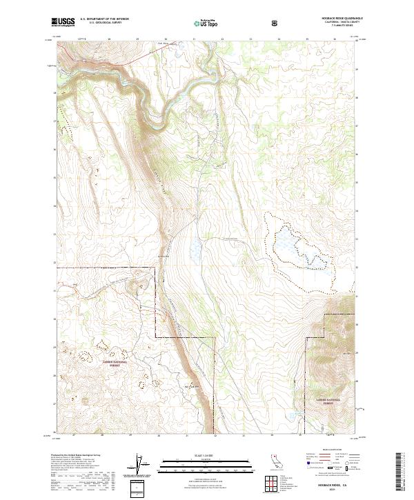
2021 Map of Hogback Ridge
USGS Topo · Published 2021About this map
Hogback Ridge dominates this northern California landscape, forming a dramatic north-south spine between the Fall River Valley and the expansive heights of the Lassen National Forest. The northern reach of the map is defined by the Pit River, where the water drops over Pit River Falls near the Pit No 1 Powerhouse Rd. The terrain is characterized by massive volcanic benches and escarpments, most notably the Hat Creek Rim which runs along the southern portion of the quadrangle.
Find a feature on this map
27 named features on this map. Tap any name to fly to it.
Don’t see what you’re looking for? This feature index may not catch every label — zoom into the map to look around manually.
Map Details
Editions of this 2021 Hogback Ridge Map
This is the sole edition of this map. No revisions or reprints were ever made.
Other maps of this area

1886 · Lassen Peak
USGS Topo · 1:250,000

1886 · Modoc Lava Bed
USGS Topo · 1:250,000

1892 · Modoc Lava-Bed
USGS Topo · 1:250,000

1892 · Lassen Peak
USGS Topo · 1:250,000

1894 · Lassen Peak
USGS Topo · 1:250,000

1932 · Bartle
USGS Topo · 1:96,000

1935 · Burney
USGS Topo · 1:96,000

1939 · Burney
USGS Topo · 1:125,000

1939 · Halls Flat
USGS Topo · 1:125,000

1939 · Bartle
USGS Topo · 1:125,000