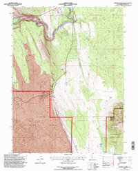
1995 Map of Hogback Ridge
USGS Topo · Published 1997About this map
The dramatic volcanic landscape of Shasta County is prominently displayed through the striking elevation changes of Hogback Ridge and the Hat Creek Rim. This mid-1990s survey by the U.S. Forest Service reveals a terrain defined by extensive Lava fields and geologic activity, where the Pit River carves through the earth creating the Pit River Falls. Industrial and utility infrastructure is concentrated near the river, including a Powerhouse, Substa, and Surge Tank, alongside multiple Cinder Pits and a Pit mine.
Find a feature on this map
21 named features on this map. Tap any name to fly to it.
Don’t see what you’re looking for? This feature index may not catch every label — zoom into the map to look around manually.
Map Details
Editions of this 1995 Hogback Ridge Map
This is the sole edition of this map. No revisions or reprints were ever made.
Other maps of this area

1886 · Lassen Peak
USGS Topo · 1:250,000

1886 · Modoc Lava Bed
USGS Topo · 1:250,000

1892 · Modoc Lava-Bed
USGS Topo · 1:250,000

1892 · Lassen Peak
USGS Topo · 1:250,000

1894 · Lassen Peak
USGS Topo · 1:250,000

1932 · Bartle
USGS Topo · 1:96,000

1935 · Burney
USGS Topo · 1:96,000

1939 · Burney
USGS Topo · 1:125,000

1939 · Halls Flat
USGS Topo · 1:125,000

1939 · Bartle
USGS Topo · 1:125,000