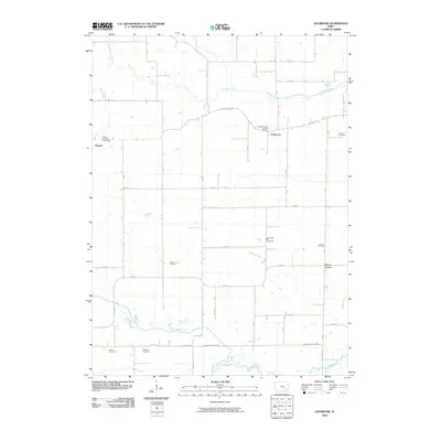
2010 Map of Holbrook
USGS Topo · Published 2010About this map
The North English River and South English River converge in this rural Iowa landscape, defining a region where small settlements and numerous family and parish burial grounds mark the history of the land. Parnell sits on the western edge, while the unincorporated village of Holbrook is central to the area's social geography, anchored by Saint Michaels Catholic Cemetery. The map reveals a dense network of township roads, such as Co HWY f52, which link together disparate farmsteads and historic rural centers like Green Center.
Find a feature on this map
44 named features on this map. Tap any name to fly to it.
Don’t see what you’re looking for? This feature index may not catch every label — zoom into the map to look around manually.
Map Details
Editions of this 2010 Holbrook Map
This is the sole edition of this map. No revisions or reprints were ever made.
Other maps of this area

1891 · Oxford
USGS Topo · 1:62,500

1894 · Oxford
USGS Topo · 1:62,500

1903 · Fairfax
USGS Topo · 1:125,000

1954 · Des Moines
USGS Topo · 1:250,000

1956 · Des Moines
USGS Topo · 1:250,000

1957 · Des Moines
USGS Topo · 1:250,000

1958 · Davenport
USGS Topo · 1:250,000

1961 · Davenport
USGS Topo · 1:250,000

1962 · Davenport
USGS Topo · 1:250,000

1965 · South English
USGS Topo · 1:24,000