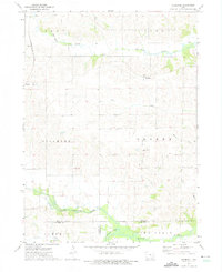
1973 Map of Holbrook
USGS Topo · Published 1975About this map
The North English River and its southern fork dominate the lower landscape of this Iowa County region, marking the boundary with Keokuk County. Just north of the river, the small rural settlement of Holbrook serves as a central landmark, surrounded by a high density of early burial grounds that are vital for local family history research. These include St Josephs Cem near Parnell, the Piersol Cem, and St Patricks Cem in the southern townships. The transportation corridor in the northwest corner is defined by the Chicago Milwaukee St Paul and Pacific railroad line. The map illustrates a highly organized agricultural grid divided into townships like Fillmore and Greene, where smaller landmarks like Champion Hill Ch and the McArtor Cem suggest the locations of established community hubs in the early 1970s.
Find a feature on this map
27 named features on this map. Tap any name to fly to it.
Don’t see what you’re looking for? This feature index may not catch every label — zoom into the map to look around manually.
Map Details
Editions of this 1973 Holbrook Map
This is the sole edition of this map. No revisions or reprints were ever made.
Other maps of this area

1891 · Oxford
USGS Topo · 1:62,500

1894 · Oxford
USGS Topo · 1:62,500

1903 · Fairfax
USGS Topo · 1:125,000

1954 · Des Moines
USGS Topo · 1:250,000

1956 · Des Moines
USGS Topo · 1:250,000

1957 · Des Moines
USGS Topo · 1:250,000

1958 · Davenport
USGS Topo · 1:250,000

1961 · Davenport
USGS Topo · 1:250,000

1962 · Davenport
USGS Topo · 1:250,000

1965 · South English
USGS Topo · 1:24,000