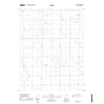
2019 Map of Holcolm Hills
USGS Topo · Published 2019About this map
Holcolm Hills and the surrounding high plains of eastern El Paso County are defined by a network of drainage ways and a grid of rural ranch roads. The landscape is marked by prominent topographic features such as Hatfield Pt and Highland Ranch Pt, which rise above the surrounding terrain. Watercourses including Horse Cr, Steels Fork, and the E Br Brackett Cr cut through the sections, often paralleled by long-established thoroughfares like N Calhan Hwy and Judge Orr Rd.
Find a feature on this map
41 named features on this map. Tap any name to fly to it.
Don’t see what you’re looking for? This feature index may not catch every label — zoom into the map to look around manually.
Map Details
Editions of this 2019 Holcolm Hills Map
This is the sole edition of this map. No revisions or reprints were ever made.
Other maps of this area

1893 · Big Springs
USGS Topo · 1:125,000

1953 · Denver
USGS Topo · 1:250,000
1954 · Ellicott
USGS Topo · 1:24,000
1954 · Haegler Ranch
USGS Topo · 1:24,000

1954 · Pueblo
USGS Topo · 1:250,000

1957 · Denver
USGS Topo · 1:250,000

1957 · Pueblo
USGS Topo · 1:250,000

1958 · Pueblo
USGS Topo · 1:250,000

1958 · Denver
USGS Topo · 1:250,000

1960 · Denver
USGS Topo · 1:250,000